Schlackenwerth 0,0 - Radiumbad St Joachimsthal 8,053
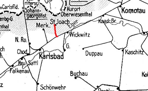
Auszug Streckenkarte 1938
Schlackenwerth 0,0 - Radiumbad St Joachimsthal 8,053
Auszug Streckenkarte 1938
Quelle: [1]
Stand der Kilometrierung: 1943
Schlackenwerth 0,0 - Radiumbad St Joachimsthal 8,053
| Schlackenwerth | 0,0 | km 169,756 der Strecke odb. Praha-Bubny St.1 0,0 - Praha-Bubny 0,423 - Milostín (Milostin, 1939-1945 Gnadendorf) 71,632 - Protektoratsgrenze Böhmen und Mähren/Sudetengau (1938-1945) 72,695 - Satkau (Sádek u Žatce) 81,745 - Komotau (Chomutov) 125,173 - Eger (Cheb) 237,252 |
| Schlackenwerth Hp | 1,3 | |
| Unterbrand | 3,1 | |
| Oberbrand | 5,4 | |
| Tunnel am Galgenberg | 18 m | |
| Radiumbad St Joachimsthal | 8,053 |
Stand der Kilometrierung: 2011
Ostrov nad Ohří (Schlackenwerth) 0,0 - Jáchymov (Radiumbad St Joachimsthal) 8,8
|
Ostrov nad Ohří (Schlackenwerth) |
0,0 | km 169,756 der Strecke Praha (Prag) 0,0 - Chomutov (Komotau) 125,173 - Cheb (Eger) 237,252 |
|
Ostrov nad Ohří zastávka (Schlackenwerth Hp) |
2,0 | |
| Dolní Žďár (Unterbrand) | 3,8 | |
| Horní Žďár (Oberbrand) | 6,1 | |
| Jáchymovský tunel | 18 m | |
|
Jáchymov (Radiumbad St Joachimsthal) |
8,8 |
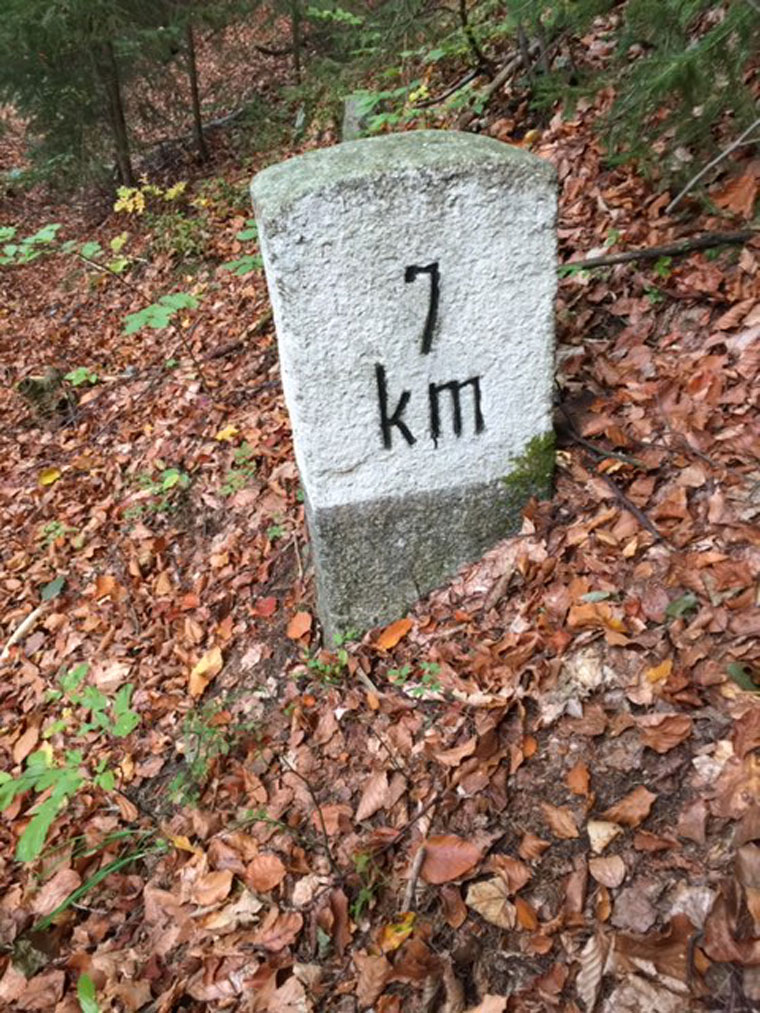
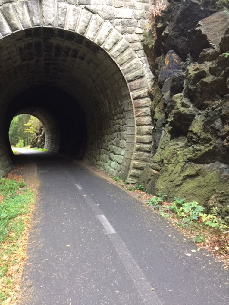
km 7,0 am Jáchymovský tunel (Tunnel am Galgenberg)
Foto: D.H., Oktober 2018
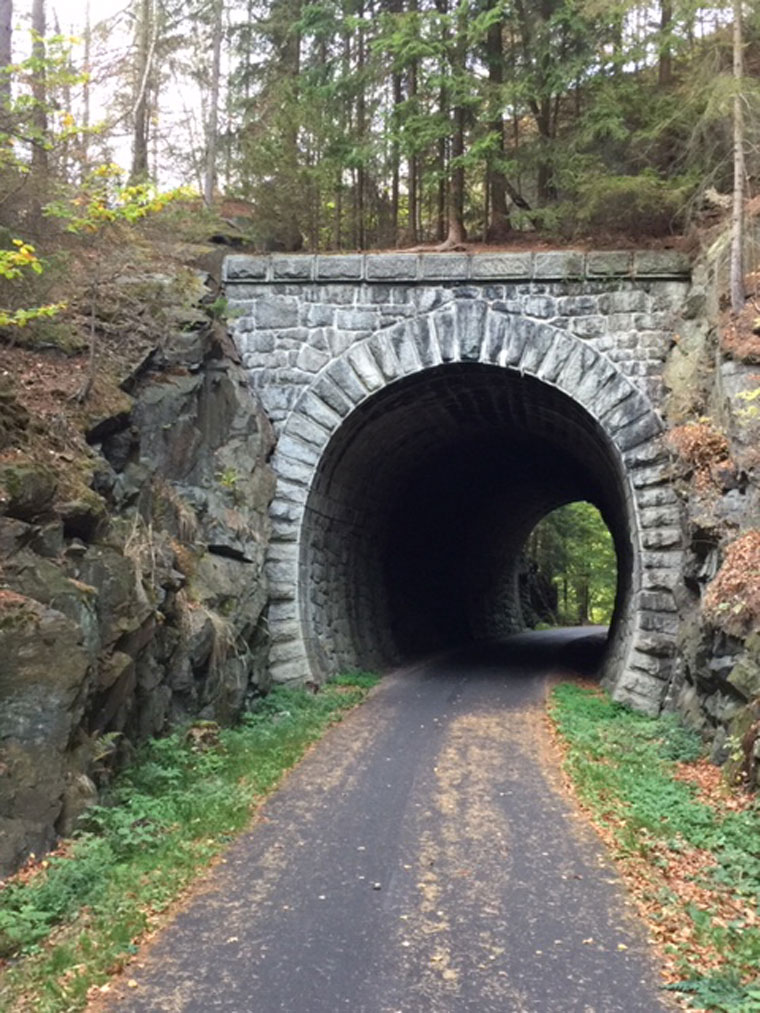
Jáchymovský tunel (Tunnel am Galgenberg) - Südportal
Foto: D.H., Oktober 2018
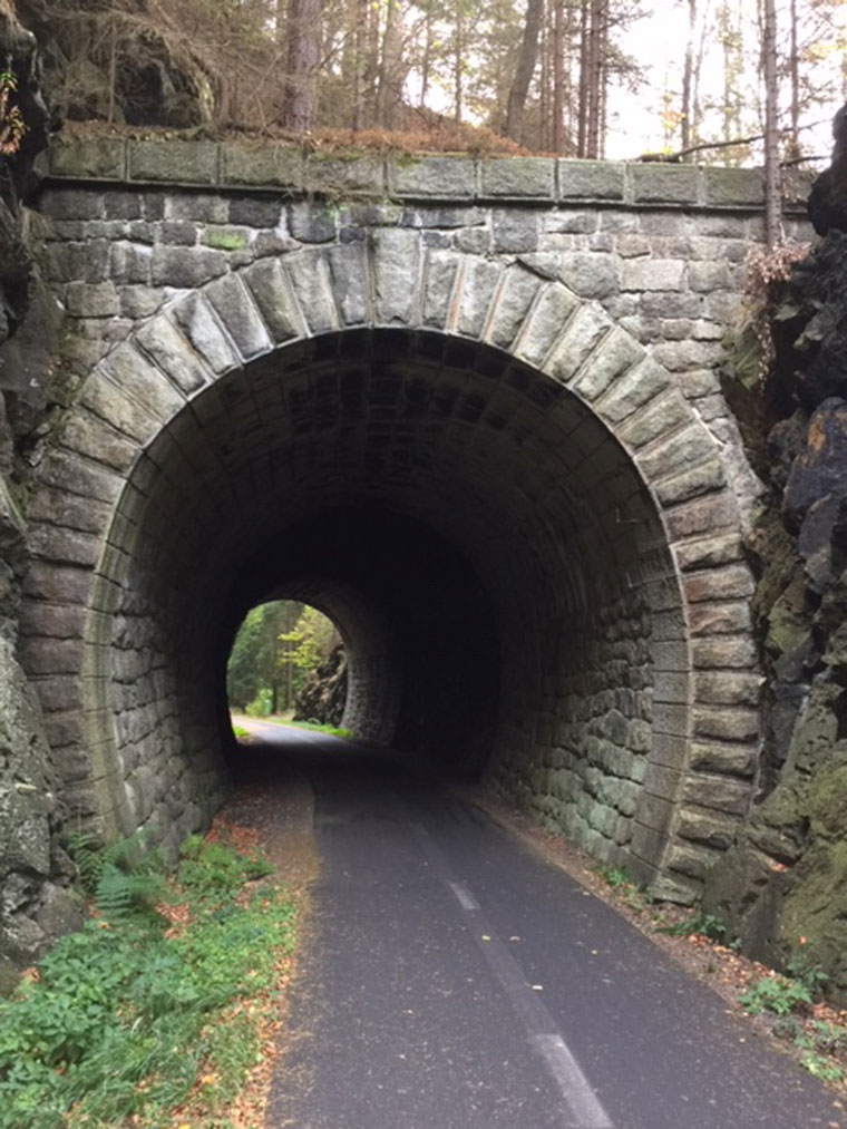
Jáchymovský tunel (Tunnel am Galgenberg) - Nordportal
Foto: D.H., Oktober 2018
Jáchymovský tunel (Tunnel am Galgenberg) - Nordportal
Foto: D.H., Oktober 2018
| Startseite | Strecken in Deutschland (Tabelle1) | Strecken in Thüringen | Kilometrierung | Impressum |